
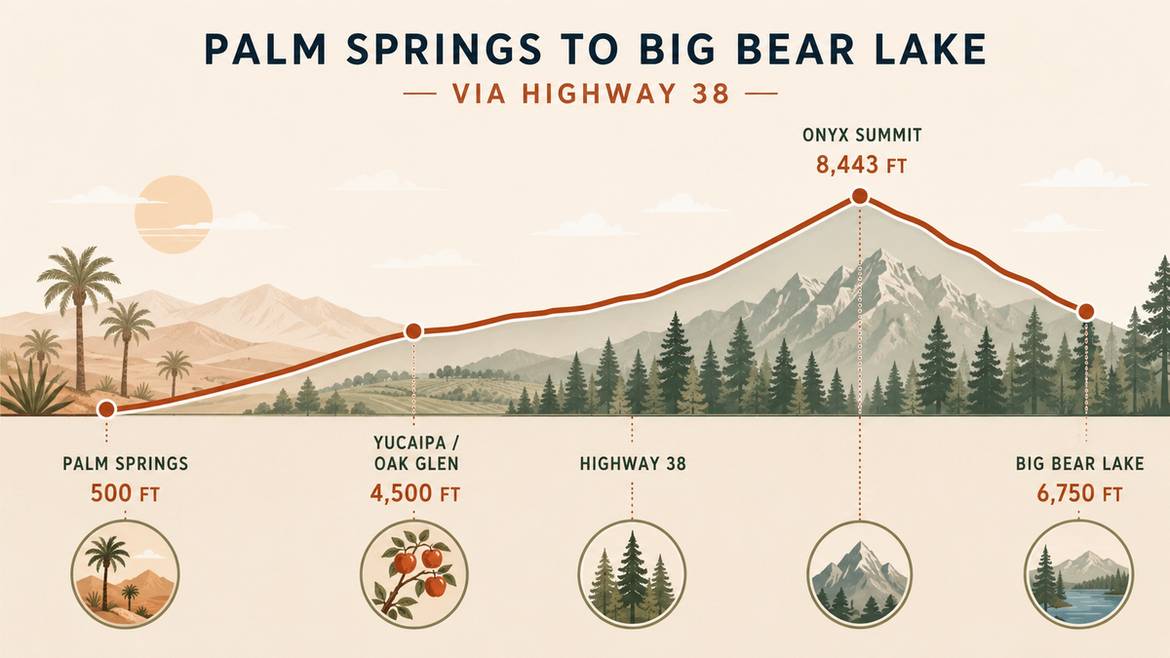
The drive from Palm Springs to Big Bear Lake is one of Southern California’s most dramatic short road trips. In roughly two hours, you climb from a desert floor sitting around 500 feet above sea level to an alpine lake at 6,750 feet, passing apple orchards, waterfalls, forested canyons, and the highest paved pass on Highway 38, Onyx Summit at 8,443 feet.
Most travelers who make this trip never realize how much they’re driving past. The fastest GPS route bypasses Oak Glen’s apple country, skips the pull-outs above the Santa Ana River, and misses the small mountain villages where locals actually stop to eat. This Palm Springs to Big Bear local route and stops guide is built for the traveler who wants the scenic version, the one with a piece of warm apple pie in Yucaipa, a photo above the clouds at Onyx Summit, and a slow arrival into Big Bear Lake with time to walk the shoreline before check-in.
We put this together the way we plan our own guests’ drives at Apek Rentals. Every stop below is a real place with real reviews, mapped in the order you’ll pass it heading north.
Route Overview: The Scenic Highway 38 Path
There are three main roads into Big Bear Lake: Highway 330 through Highland, Highway 18 through Lucerne Valley, and Highway 38 through Redlands and Yucaipa. From Palm Springs, the Highway 38 route is the one locals recommend for a first visit. It’s about 90 miles and takes roughly two hours in normal traffic, versus 82 to 83 miles and 90 minutes on the faster Highway 330 approach. The extra half hour buys you a gentler climb, less weekend congestion, and the string of stops that make this article worth reading.
Turn-by-turn from Palm Springs:
- Take I-10 West toward Redlands and Yucaipa.
- Exit at County Line Road in Yucaipa and turn right.
- Follow County Line Road to Bryant Street and turn left.
- Continue on Bryant Street until it meets CA-38, then turn north onto Highway 38.
- Climb Mill Creek Canyon into the San Bernardino National Forest, cross Onyx Summit at 8,443 feet, then descend to the junction with CA-18 near Big Bear.
- Follow signs for Big Bear Boulevard into town.
Elevation-wise, this drive is more of a workout than most people expect. You gain more than 6,000 feet on the way up, so pack water, keep the fuel tank at least half full before leaving the desert, and give yourself the extra time for scenic stops rather than fighting the clock.
Now the fun part: what to actually stop for, in the order you’ll see them.
Foothill Stops: Yucaipa and Oak Glen Apple Country
Once you exit I-10 at County Line Road, you’re already climbing. Bryant Street and Oak Glen Road wind through orchards at around 4,500 feet, where the temperature is noticeably cooler than the desert you just left. This corridor is Southern California’s apple country, and it’s the single best place on the whole drive to stop for a real meal and stock up on baked goods before you head into the forest.
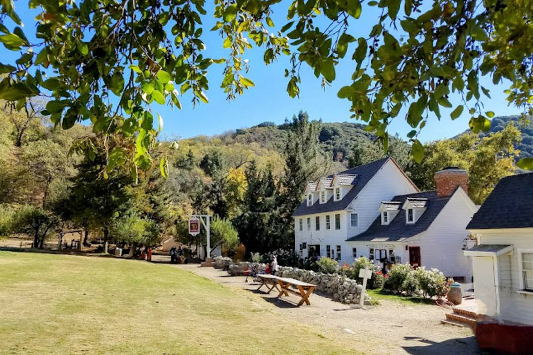
Riley’s Farm
Riley’s Farm is a working orchard and historic living-history site that has become one of Oak Glen’s signature stops. Visitors pick apples in season (typically late August through October), press their own cider, watch blacksmith and colonial-era demonstrations, and eat farm-to-table meals at the Hawk’s Head Public House.
- Rating: 4.4 stars, 2,030+ Google reviews
- Address: 12261 Oak Glen Rd, Yucaipa, CA 92399
- Website: rileysfarm.com
- Best for: Families, fall foliage, apple picking
Guests consistently describe the atmosphere as immersive and family-friendly, with wagon rides and orchard walks that keep kids busy for hours.
Los Rios Rancho
Los Rios Rancho is Oak Glen’s largest apple ranch and one of the most beloved stops on the corridor. The property blends a huge farm store (fresh cider, pies, jams, and local produce), picnic lawns under the oaks, U-pick fields in season, and a casual BBQ counter that’s a favorite lunch stop for drivers headed up to Big Bear.
- Rating: 4.6 stars, 2,240+ Google reviews
- Address: 39611 Oak Glen Rd, Yucaipa, CA 92399
- Website: losriosrancho.com
- Best for: Cider tasting, picnics, buying pies to bring to the cabin
If you only stop once in Oak Glen, this is the safest bet. The apple pie and hot cider donuts are the runaway favorites in the reviews.
Apple Annie’s Bakery & Restaurant
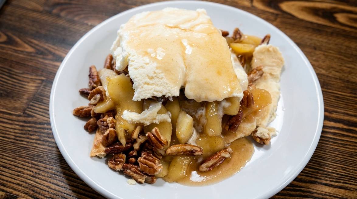
Apple Annie’s is the sit-down comfort-food anchor of Oak Glen. Country breakfasts, chicken pot pies, and, of course, warm apple pie topped with cinnamon ice cream have made this a multi-generation weekend tradition for families driving up from the Inland Empire and Coachella Valley.
- Rating: 4.2 stars, 2,790+ Google reviews
- Address: 38480 Oak Glen Rd, Oak Glen, CA 92399
- Website: oaktreemountain.com/apple-annies
- Best for: A full sit-down breakfast or lunch before the mountain climb
Weekends can be busy, especially during peak apple season. Arriving before 11 a.m. usually means little to no wait.
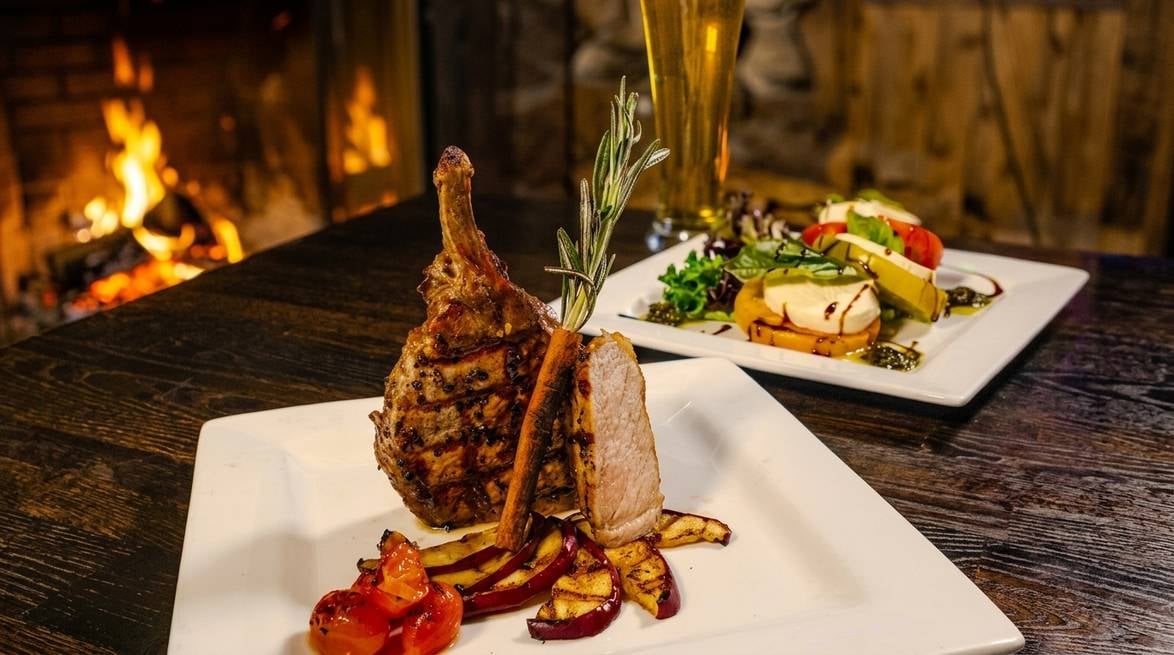
Oak Glen Steak House & Saloon
If you’re driving up in the late afternoon and want a hot meal before the last hour of mountain switchbacks, Oak Glen Steak House is the classic choice. Think ribeyes, mountain trout, and a saloon-style dining room with a full bar and heavy wooden beams.
- Rating: 4.3 stars, 1,388+ Google reviews
- Address: 38490 Oak Glen Rd, Yucaipa, CA 92399
- Website: oakglensteakhouse.com
- Best for: A sit-down steak dinner before you hit the forest
Portions run generous. Reviewers regularly call out the prime rib and the atmosphere as reasons they return year after year.
Mountain Stops Along Highway 38
Past Oak Glen, Highway 38 leaves apple country and starts the real climb. You’ll enter the San Bernardino National Forest, drop briefly into Mill Creek Canyon, and follow the Santa Ana River into deep pine forest. Cell service gets spotty in stretches, so it’s worth downloading offline maps in Yucaipa. The four stops below are the ones locals actually use, and they’re spaced out to give you natural breaks as you climb.
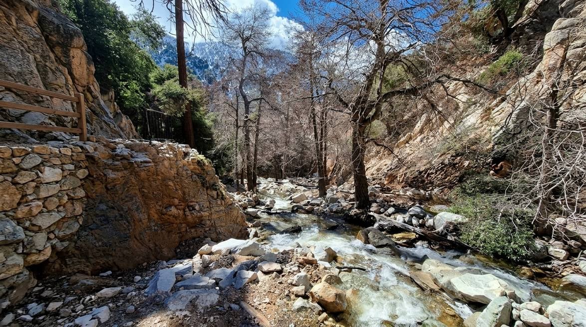
Big Falls Trail (Forest Falls)
Big Falls is Southern California’s tallest year-round waterfall and one of the shortest scenic hikes in the region, less than a quarter-mile from the parking area to the main viewing platform. The falls plunge more than 200 feet down a granite face and are especially dramatic in spring when the snowmelt is heaviest.
- Rating: 4.5 stars on Google
- Address: Forest Falls, CA 92339 (short drive off Highway 38 via Valley of the Falls Drive)
- Best for: Quick leg stretch, waterfall photos, kids
A San Bernardino National Forest Adventure Pass is required to park in the Falls Recreation Area. Stay on the marked trail, several accidents each year happen when visitors climb past the safety fence.
Jenks Lake
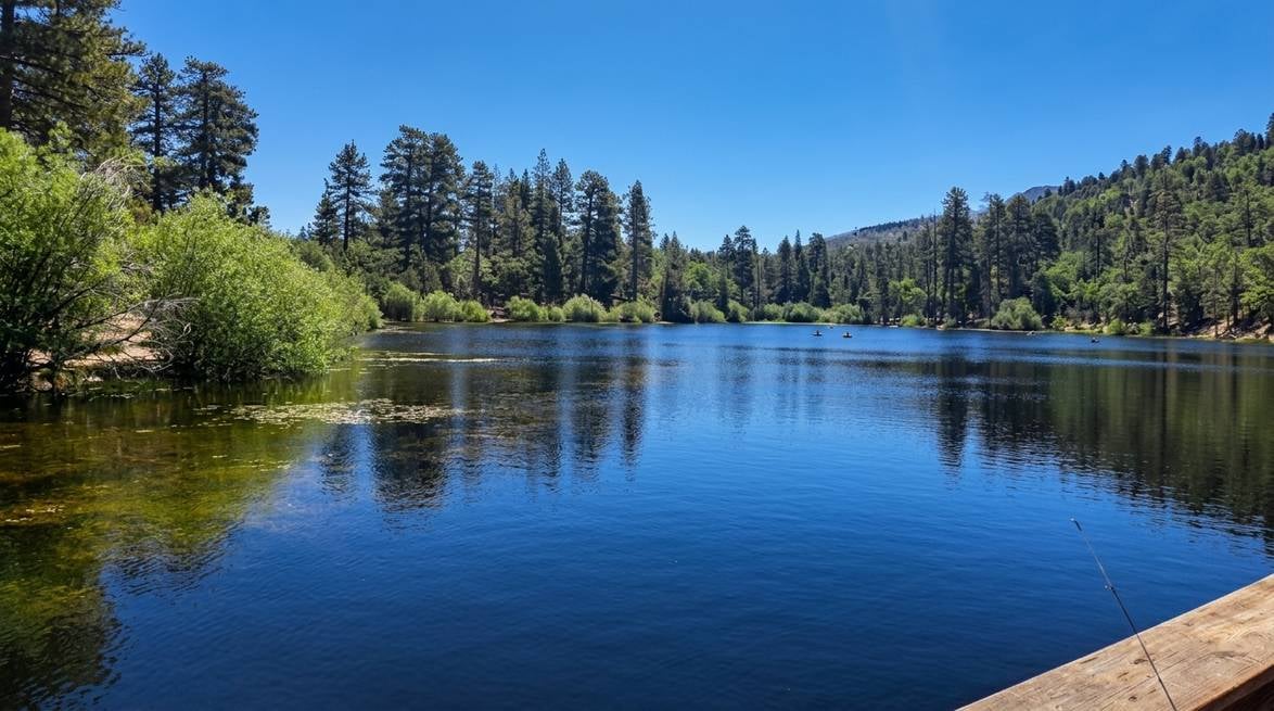
Just off Highway 38 near Barton Flats, Jenks Lake is the classic small mountain lake stop that most first-time visitors don’t know about. There are two lakes (Upper and Lower Jenks), a paved parking area, picnic tables, and shoreline access for catch-and-release fishing. It’s a quick, quiet detour that feels like a scene from a much longer drive north.
- Rating: 4.7 stars, 178+ Google reviews
- Location: Highway 38 near Barton Flats, San Bernardino National Forest
- Best for: A picnic, a swim in warm months, a quiet 20-minute reset
An Adventure Pass is required. Restrooms are on site. This is a great stop for families with kids who need to run before the last stretch of the drive.
Arriving at Big Bear Lake: Top Lakeside Stops
Once Highway 38 meets Highway 18, you’re 10 minutes from the lake. This is where the drive stops being just travel and starts being a vacation. The stops below sit right along the shoreline as you loop from the east side (where you’ll arrive) around toward the south shore and The Village. If you’ve timed it right, you’ll roll into Big Bear Lake mid-afternoon with plenty of daylight to explore.
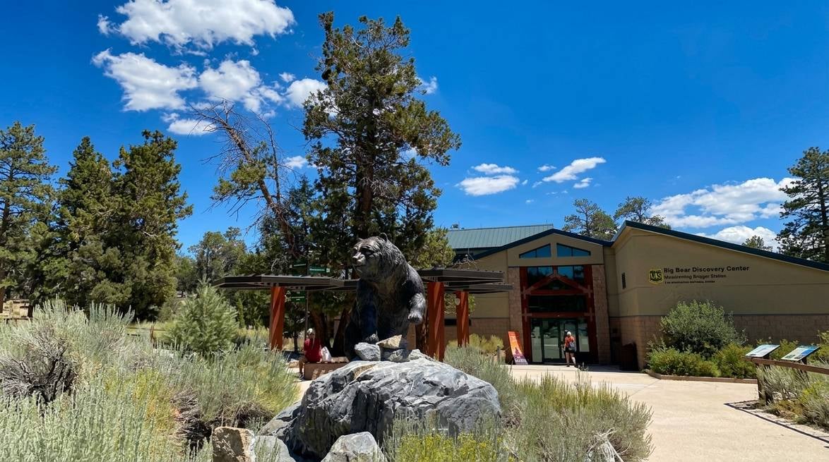
Big Bear Discovery Center
Run by the Southern California Mountains Foundation in partnership with the San Bernardino National Forest, the Discovery Center is the smartest first stop when you arrive. Rangers can hand you a current trail map, tell you which lookouts are open, and (crucially in winter) confirm real-time road status. It’s also a genuinely fun stop: interactive exhibits, a native-plant garden, and a nature store.
- Rating: 4.6 stars, 1,617+ Google reviews
- Address: 40971 North Shore Drive / Hwy 38, Fawnskin, CA 92333
- Website: mountainsfoundation.org/big-bear-discovery-center
- Best for: Trail info, kids’ activities, current road and trail conditions
Adventure Passes are sold here too, which saves a trip if you’re planning any national-forest parking the next day.
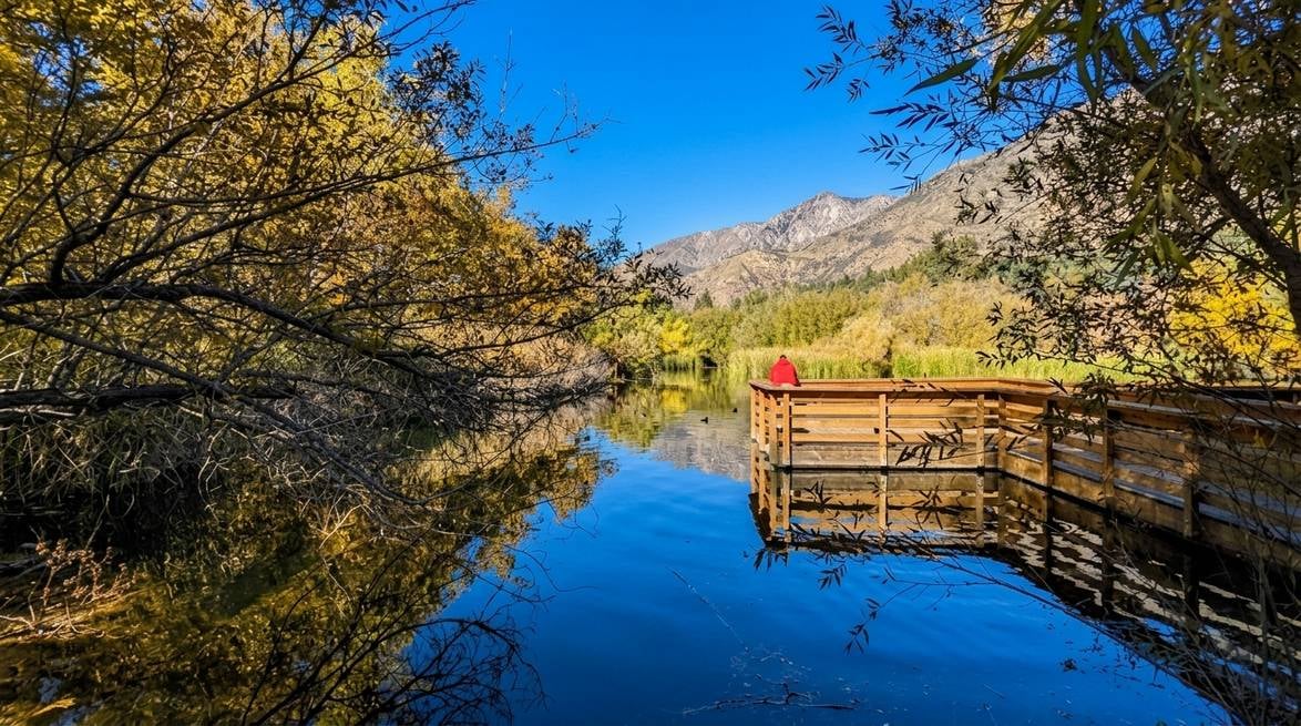
Stanfield Marsh Wildlife and Waterfowl Preserve
Stanfield Marsh is the calmest, most beginner-friendly nature stop in Big Bear. A short boardwalk loops out over a shallow marsh at the east end of the lake, with observation platforms that put you eye level with herons, egrets, ospreys, and bald eagles in winter. Parking is free, restrooms are clean, and the walk itself is fully paved and wheelchair-accessible.
- Rating: 4.7 stars, 1,317+ Google reviews
- Address: 42300 Big Bear Blvd, Big Bear, CA 92314
- Best for: Birdwatching, easy walks, families with strollers
Sunrise and sunset here are outstanding. Bring binoculars if you have them.
Alpine Pedal Path
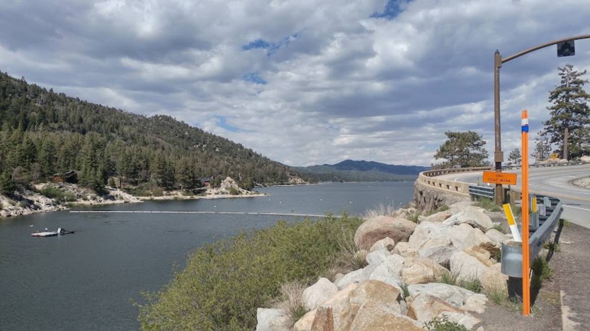
The Alpine Pedal Path is a paved 3.2-mile shoreline path along the north side of Big Bear Lake, running from Stanfield Cutoff west toward Boulder Bay. It’s flat, family-friendly, and dotted with picnic areas and photo stops that give you an unbeatable first look at the lake and the mountains around it. If you have bikes, this is the ride. If you don’t, it’s a beautiful walk.
- Rating: 4.7 stars, 458+ Google reviews
- Trailhead: 740 Stanfield Cutoff, Big Bear, CA 92314
- Website: fs.usda.gov (San Bernardino National Forest)
- Best for: Easy biking, jogging, lakeside strolls
The trail is dog-friendly on leash and stays snow-covered in parts through early spring. Sunset light hits the lake from the west, so late afternoon is prime time.
Bear Valley Dam Overlook
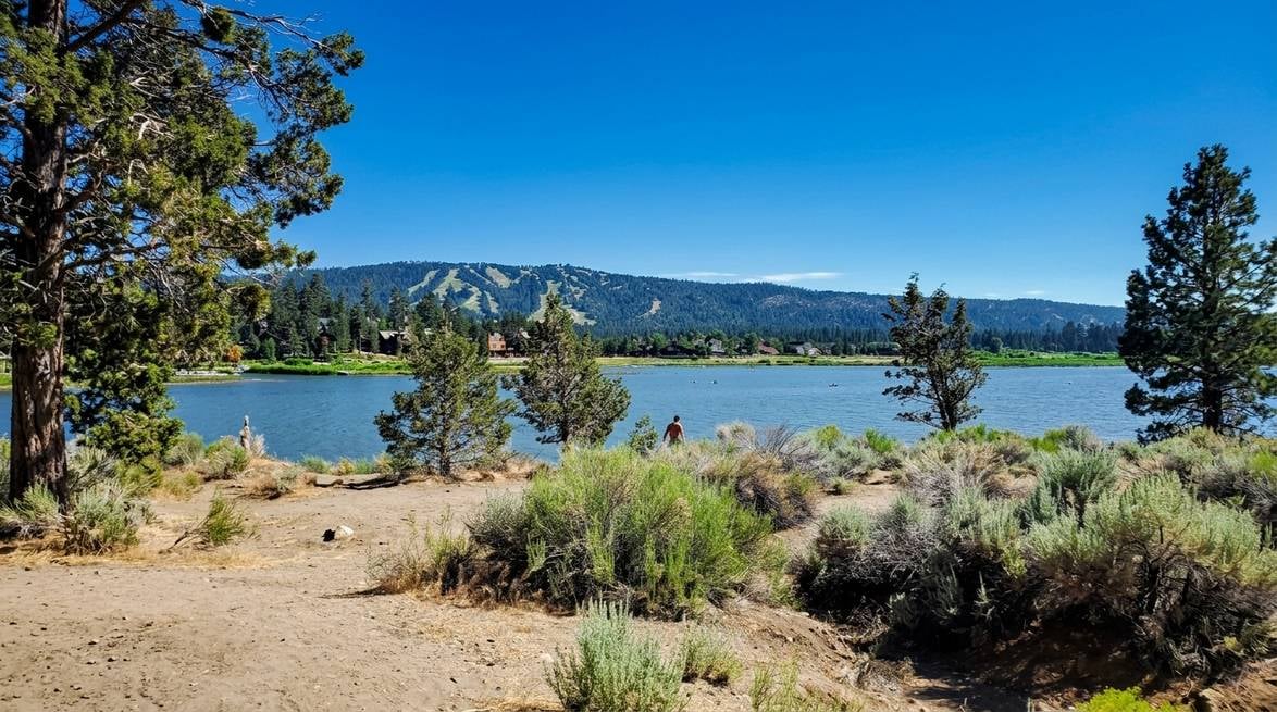
Also known simply as the Big Bear Dam Overlook, Bear Valley Dam holds back Big Bear Lake and offers one of the widest panoramic views on the whole shoreline. The pullout is roadside on Big Bear Boulevard, so it takes 5 minutes and rewards you with a shot that captures the length of the lake, the surrounding forested ridges, and (on clear days) the ski runs at Snow Summit.
- Rating: 4.7 stars, 526+ Google reviews
- Address: 66 Big Bear Blvd, Fawnskin, CA 92333
- Best for: A 5-minute panoramic photo stop, seeing current lake levels
It’s also a great spot to appreciate the engineering: the original dam dates to 1884 and was rebuilt in 1912.
Boulder Bay Park
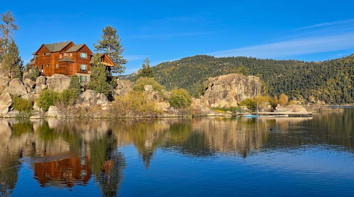
Save Boulder Bay Park for last. It’s the most photographed spot in Big Bear Lake for a reason: massive glacial boulders sit right at the waterline, framing perfect reflections of the mountains across the lake. A short paved loop connects a small dock, picnic tables, and grass areas where families spread out for lunch. Sunset here is spectacular.
- Rating: 4.8 stars, 306+ Google reviews (one of the highest-rated stops on the entire lake)
- Address: 39098 Big Bear Blvd, Big Bear Lake, CA 92315
- Best for: Sunset photography, easy shoreline walks, that “we made it” arrival photo
Parking fills up on summer weekends after 3 p.m., so aim earlier or later if you can. Recent reviewers describe it as “one of the most peaceful and scenic places” on the lake and highlight the calm morning and sunset light.
Driving Tips: Weather, Chains, and When to Go
The Palm Springs to Big Bear drive changes character with the seasons. Here’s what to plan for, whichever month you’re traveling.
Check road conditions the morning you leave
Highway 38 has been subject to storm-repair closures. Depending on the month, sections between Mill Creek Road and Hills Ranch Road can be fully closed Monday through Friday from 7:00 AM to 5:00 PM, with the road reopening on nights and weekends. If Highway 38 is restricted, use Highway 18 via Lucerne Valley or Highway 330 via Running Springs as alternates.
Before you leave the desert:
- Check Caltrans QuickMap or call 1-800-427-7623 for current closures and chain controls.
- Call the Big Bear Lake Visitors Center at 800-424-4232 for local weather.
- Confirm any active construction on CA-18 and SR-38.
Winter chain requirements (November through April)
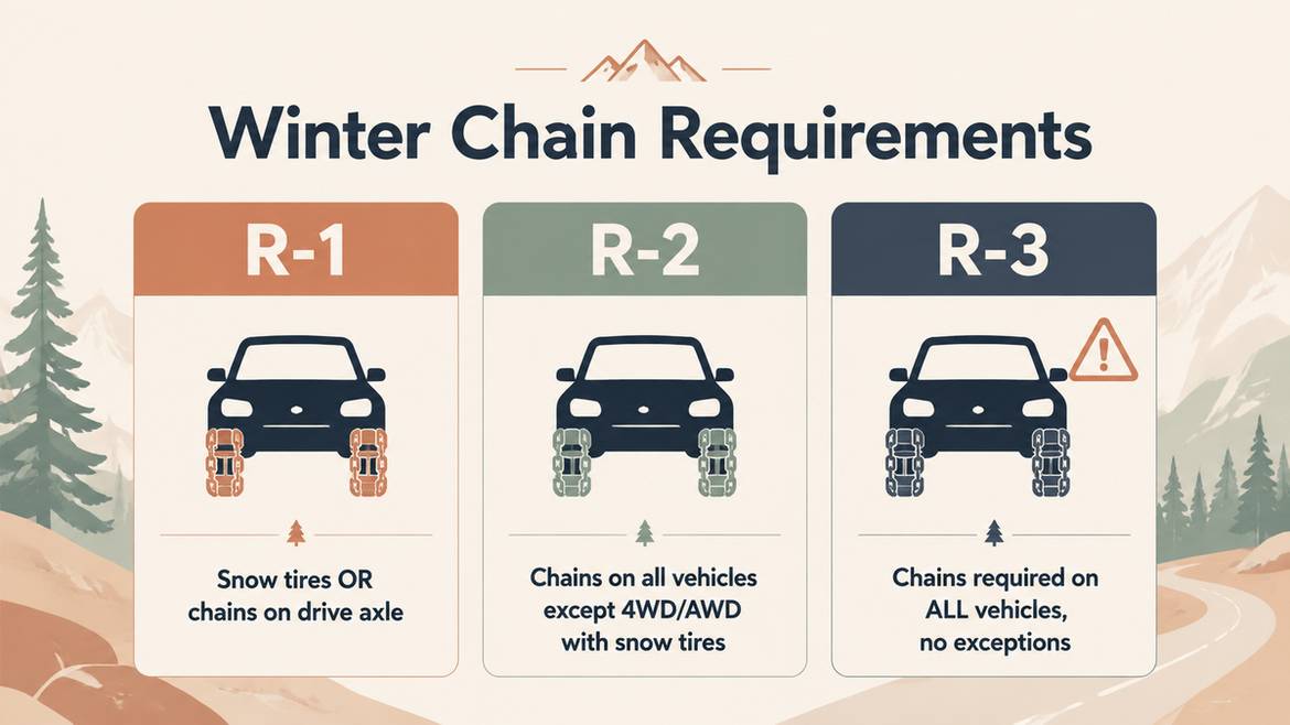
California requires all vehicles traveling into the San Bernardino Mountains to carry tire chains during winter months, even if it isn’t snowing. Caltrans and CHP use three chain-control levels:
- R-1: Chains required on all commercial vehicles. Passenger cars need either snow-tread tires or chains on the drive axle.
- R-2: Chains or traction devices required on all vehicles, except 4WD/AWD with snow-tread tires on all four wheels. Even exempt vehicles must carry chains.
- R-3: Chains required on all vehicles, no exceptions. Travel is discouraged.
Practice putting your chains on in your driveway before the trip. When CHP is directing traffic at a chain-up point, you don’t want to be the driver holding up the line.
Seasonal tips at a glance
- Winter (Nov to Apr): Arrive by early afternoon, carry chains, drive with headlights on, and add 30 to 60 minutes to your estimate. Snow can arrive in October and linger through April at Big Bear’s 6,750-foot elevation.
- Spring (Apr to Jun): Snowmelt swells waterfalls (great for the Big Falls detour) but also brings rockfall and mud. Late storms can still drop snow above 7,000 feet.
- Summer (Jun to Sep): The main challenge is construction, not weather. Avoid weekday 7 AM to 3 PM windows on CA-18 when possible. Palm Springs can be 100°F+ while Big Bear stays in the 70s, so your engine cooling and brakes both work harder than usual.
- Fall (Sep to Oct): Peak apple season in Oak Glen, first light snows possible in October. This is arguably the best month for the drive.
Practical vehicle checklist
- At least half a tank of fuel leaving Palm Springs (fuel is limited and pricier past Yucaipa).
- Water, layers, snacks.
- A flashlight, blanket, and fully charged phone.
- Tire chains from November through April, no exceptions.
- Check tire pressure, coolant, and wipers before you go.
Ready to Plan Your Palm Springs to Big Bear Escape?
The drive from Palm Springs to Big Bear is the kind of trip that repays a little planning many times over. Give yourself a half day for the road, stop in Oak Glen, stretch your legs at Big Falls or Jenks Lake, and time your arrival for late afternoon so you can walk the shore at Boulder Bay before dinner.
When you’re ready to book the stay that makes it all worthwhile, browse our handpicked Big Bear Lake vacation rentals or get in touch and we’ll help you match the right home to your group and dates. From cozy A-frames to modern lakefront lodges, we’ll make sure the hardest part of your trip is the drive, not the stay.
Frequently Asked Questions
How long is the drive from Palm Springs to Big Bear Lake?
Via the Highway 38 route through Yucaipa and Oak Glen, it’s approximately 90 miles and about 2 hours without stops. The faster Highway 330 route via I-10 and CA-18 is about 82 to 83 miles and takes roughly 90 minutes in normal traffic. With scenic stops in Oak Glen and along Highway 38, plan a half day.
What’s the best route from Palm Springs to Big Bear?
For a first visit or a scenic drive, take I-10 West to the County Line Road exit in Yucaipa, follow Bryant Street to Highway 38, and stay on 38 over Onyx Summit until it merges with Highway 18 near Big Bear. For the fastest drive, take I-10 to CA-330 through Running Springs to CA-18.
Do I need snow chains to drive to Big Bear in winter?
Yes, California requires all vehicles to carry tire chains when traveling into the San Bernardino Mountains from November through April, even in clear weather. When chain controls are in effect, all vehicles must have chains on board, and 2WD vehicles typically must install them at R-1 and R-2 levels. Check current chain requirements on Caltrans QuickMap the morning you leave.
Is Highway 38 to Big Bear open right now?
Highway 38 has had ongoing storm-repair closures, including scheduled weekday daytime closures between Mill Creek Road and Hills Ranch Road. Always verify current status via Caltrans (1-800-427-7623) or the Big Bear Lake Visitors Center (800-424-4232) before departing, and have Highway 18 via Lucerne Valley or Highway 330 via Running Springs as backup routes.
What’s the elevation change from Palm Springs to Big Bear?
You’ll climb from roughly 500 feet in Palm Springs to a maximum of 8,443 feet at Onyx Summit on Highway 38, then descend to about 6,750 feet at Big Bear Lake. That’s more than 6,000 feet of net elevation gain, so expect cooler temperatures, thinner air, and stronger vehicle strain on the climb.
Where can I stop to eat on the way?
The best food stops on this drive are clustered in Oak Glen (Los Rios Rancho, Apple Annie’s Bakery & Restaurant, Oak Glen Steak House & Saloon, and Riley’s Farm) and at The Oaks Restaurant in Angelus Oaks. Between Angelus Oaks and Big Bear, food options are sparse, so plan meals accordingly.